

Copy of Proclamation Regarding Cherokee Territory
Document 1795Copy of document drawn up in presence of Cherokee commissioners regarding boundary lines of Indian and U.S. land. Outlines boundary lines based on topographic landmarks. Offers protection of boundary and people abiding by law by United States.


No human transcription currently available for this document.
This transcription was generated by machine using Anthropic's Claude Code (model sonnet 4.6). It may contain errors or inaccuracies. Please verify against the document image. Learn more about our generative AI methodology.
[Page 117]
The Following is the copy of a certificate on a Parchment delivered last Summer by the President of the [undecipherable] to opoia Mingo. The lines described in it are the same as those Stated at the Conference at Nashville in presence of the Cherokee Commissioners in 1792. Knoxville January 22d 1795.
Wm Blount
George Washington President of the United States of America:
To all to whom these presents Shall come:
Know ye, that the Nation of Indians called Chickasaw inhabiting the District of Country herein described: to wit Beginning on the Ohio at the ridge which divides the waters of Tennessee and Cumberland and extends with that ridge eastwardly as far as the most eastern waters of Elk river, thence to the Tennessee at an old field where a part of Chickasaws formerly lived, this line to be So run as to include all the waters of Elk river, thence up the Tennessee and a neck of land to Tomhacunda Creek a Southern branch of the Tennessee, and up the same to its Source, then to the waters of Tombigby, that is to the west fork of long leaf pine Creek, and down it to the line of the Chickasaws and Chactaws a little below the trading path, and the Towns, Villages, Lands of the Same Community are in their persons, Towns, Villages, lands, hunting grounds and other rights and properties in the peace and under the protection of the United States of America, and all persons [undecipherable]
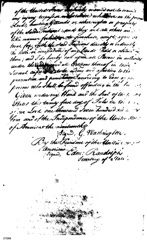
of the United States are hereby warned not to commit any injury, trespass or molestation whatsoever on the persons, Lands, hunting Grounds, or other rights or property of the Said Indians; and they and all others are in like manner forbidden to purchase, accept, agree or treat for, with the Said Indians directly or indirectly the title or occupation of any Lands held or claimed by them; and I do hereby call upon all Persons in authority under the [undecipherable] and all Citizens thereof in their several capacities to be aiding and assisting to the prosecution and punishment according to Law of all persons who Shall be found offending in the [undecipherable].
Given under my Hand and the Seal of the United States this twenty first day of July in the year of our Lord one thousand Seven hundred and ninety four and of the Independance of the United States of America the nineteenth.
Signed, G. Washington.
By the President of the United States of America—
Signed, Edm: Randolph
Secretary of State.
Type
Copy of document
Description
Copy of document drawn up in presence of Cherokee commissioners regarding boundary lines of Indian and U.S. land. Outlines boundary lines based on topographic landmarks. Offers protection of boundary and people abiding by law by United States.
Date
01/22/1795
Author
Collection
Document number
1795012290102
Page start
1
Notable persons
William Blount
President of the United States
George Washington
Opoia Mingo
Cherokee Commissioners
Indian Nation
Chickasaw
Choctaw
Edmund Randolph
Secretary of State
Notable locations
Nashville
Knoxville
Ohio River
Tennessee River
ridge
Cumberland River
Elk River
Tonohacunda Creek
southern branch
ridge
Tombigby
Long Leaf Pine Creek
trading post
hunting grounds
town
community
village
Notable items
certificate
boundary